How to get started
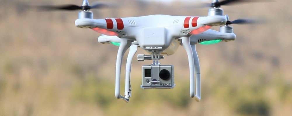
Welcome to CloudUAV!
CloudUAV is an open-source, cloud-based Research Platform that streamlines Unmanned Aerial Vehicle (UAV) workflows for Canadian researchers. CloudUAV is in development by an Internet of Things (IoT) software team at SensorUp and the Applied Geospatial Research Group at the University of Calgary, and is hosted by CANARIE.
Get Started
Create an account so you can access CloudUAV workflow
Already have an account?
Create your first project. Before we create a project, lets add our sensors, drones, and personnels into the system.
1. Create a sensor:
Menu > Sensors > Create
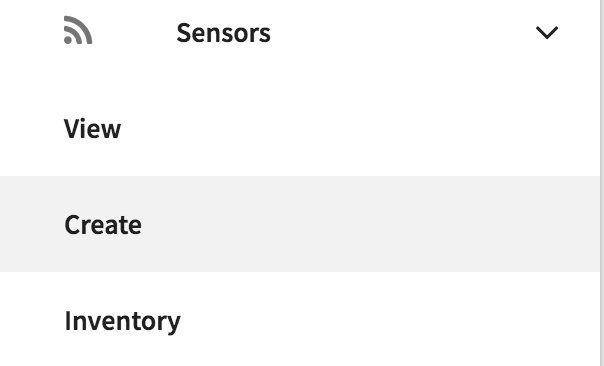
Fill in the respective fields, when done then create your sensor.
2. Create a drone:
Menu > Drones > Create
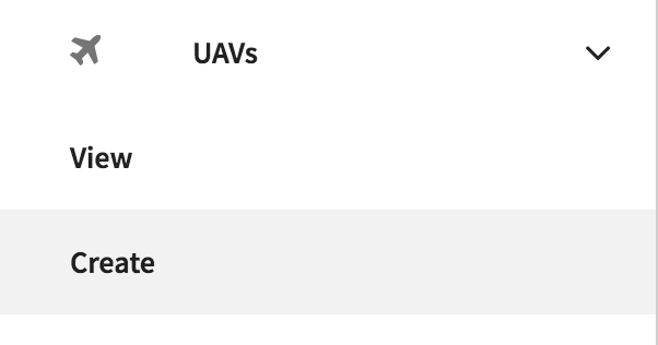
Fill in the respective fields, when done then create your drone.
3. Create a personnel:
Menu > Personnel > Create
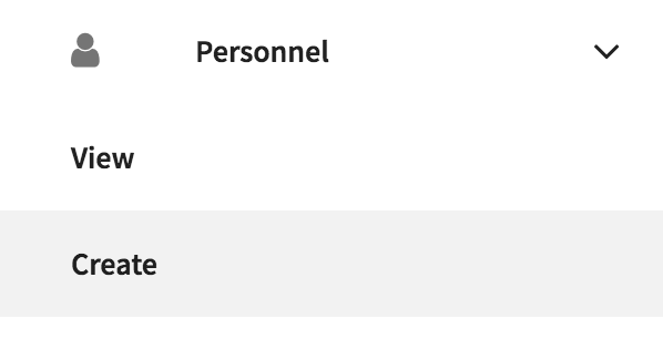
Fill in the respective fields - name, phone number, role, upload certification. When done then create your personnel.
4. Create a project:
Menu > Create
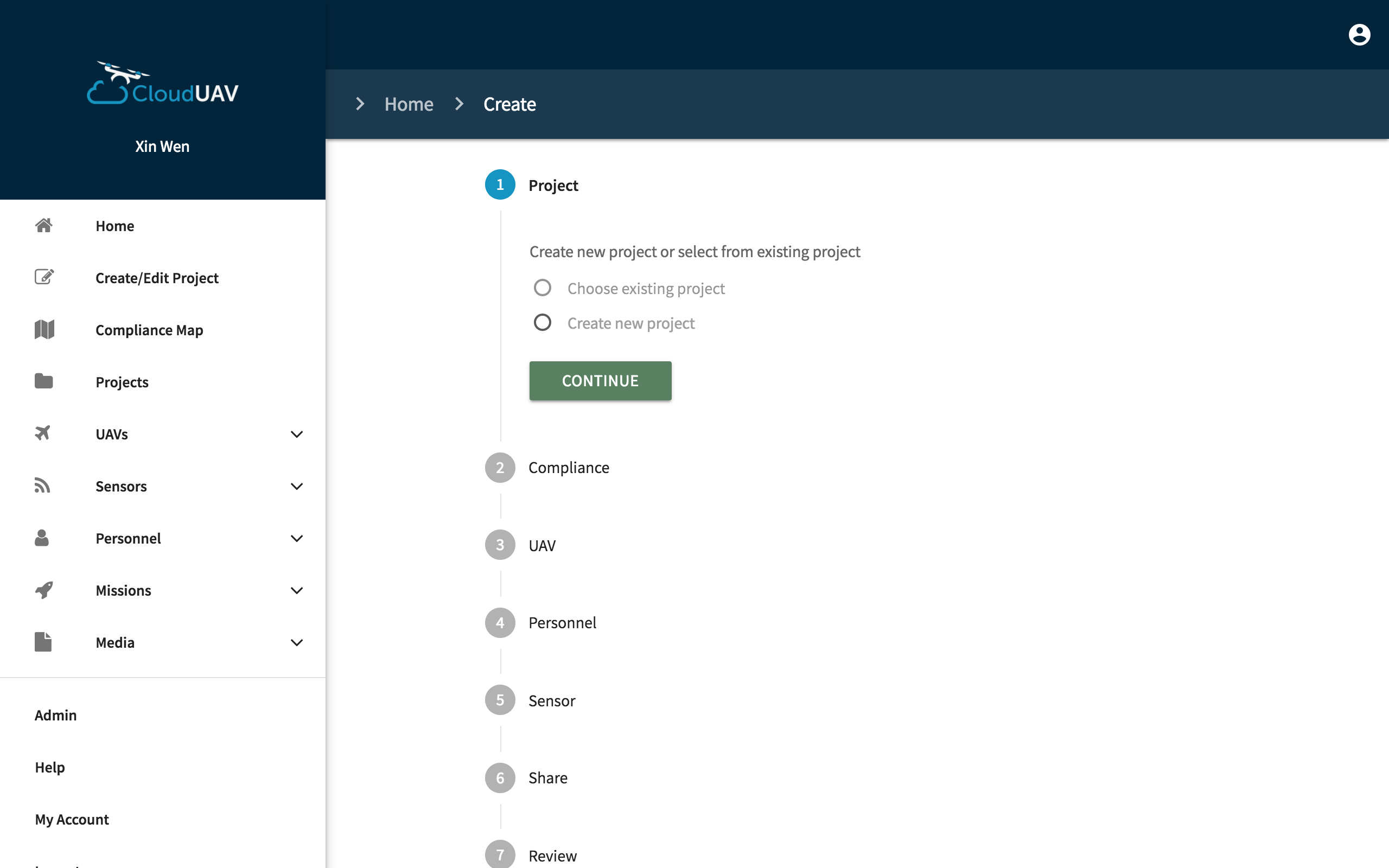
Step through the wizard and fill in all respective fields (add your drone, sensor, personnel, etc. to the project). When done, click Create.
That's it you've now created your first project.
Compliance Map
CloudUAV provides a compliance map to ensure users are flying their UAV in area that is permitted by Transport Canada.

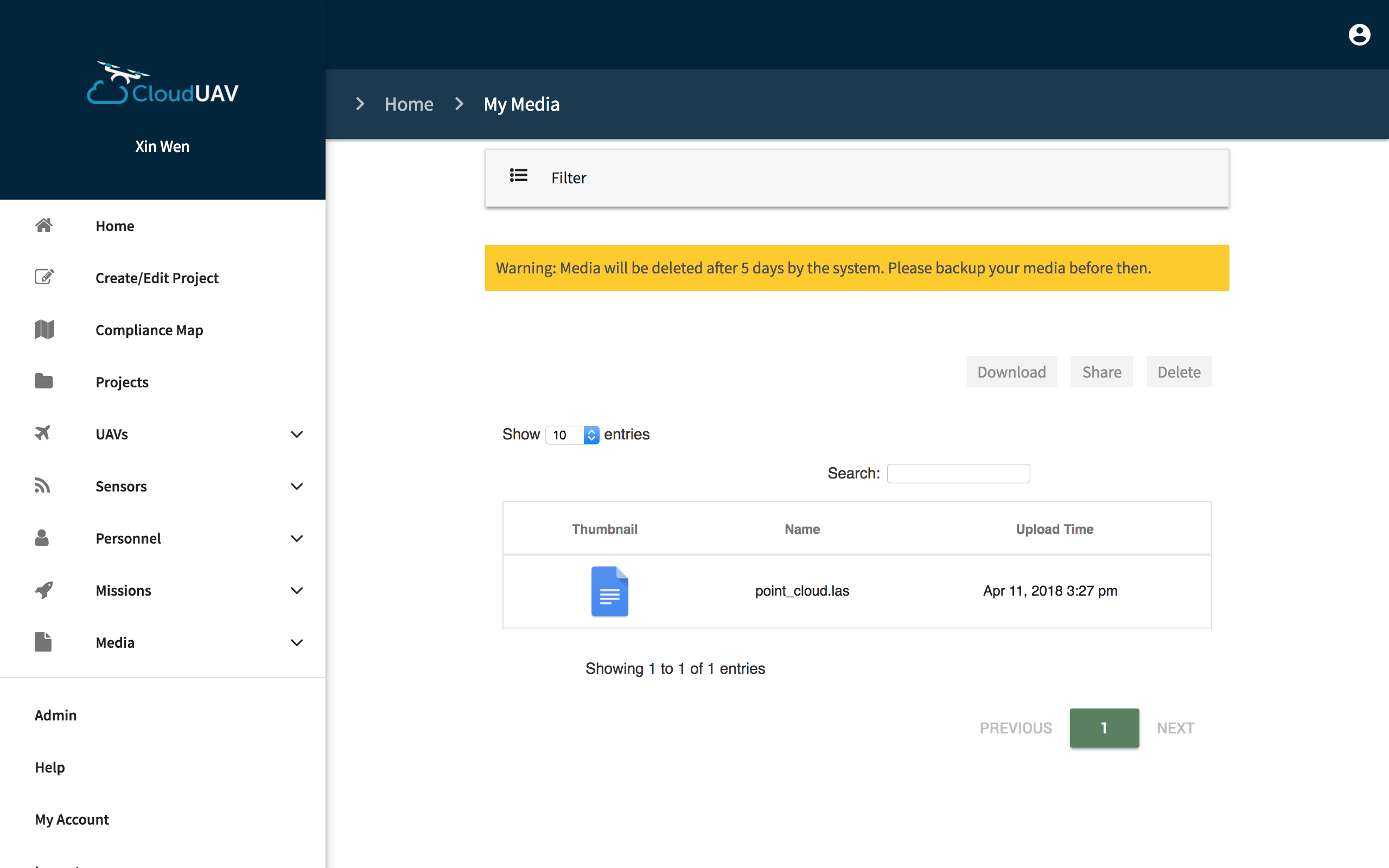
Upload UAV Files
To upload a UAV file, go to Menu > Files > Upload

Select a project and the UAV. Click upload and your file will be uploaded to the system.
What can I do with my images?
You can view your images or you can see a compiled video of your UAV images and view the locations of where those images are taken. To view this feature, in the Files section > Filter, select datastream 'images' > View Animation of Images

What do I do with my point cloud data?
You can view your point cloud data in our web application. Upload your file and click on your file. It will display the data in Plas.IO, which is a visualization for point cloud data.
Warning: it will take some time for Plas.IO to display the file depending on the size of the file. So please wait and do not leave the page.

Mission
To create a mission, go to Menu > Missions > Create

Fill in the respective fields (name, description, etc.). Select the sensor and drone that will be used on this mission. Users can only select one sensor and one drone. Select the personnel that will be on this mission, you can select multiple personnel. Once done, click create and your mission is created.
CloudUAV Mobile App
Download the CloudUAV mobile app from the Google Play store. The CloudUAV app allows users to go through a series of checklist before they start flying their UAV. This ensures users are compliant with Transport Canada rules and regulations. It also allows users to add notes while they are in their mission. All of this data is sync with the website when the app is connected to wifi.